Perkins Road Redevelopment
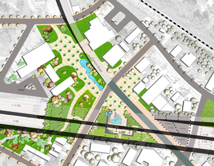
Master Plan
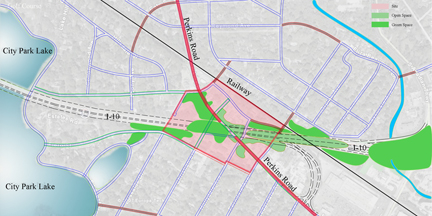
Site is located beside Perkins road and is close to City Park. The
site was divided irregularly and isolated by the Interstate 10, railway
and Perkins Road. Since Perkins road is the only road in the site that
connects east-south to west- north, this leads to high traffic on
Perkins road and makes the site very difficult and unsafe to cross.
Although the site is very close to City Park, it was blocked by some
hedges and disconnects City Park and the lake. Some individual
businesses function well, yet they lack connection.
The strategy is to connect site with open space, circulation and activities. The site should be connected to City Park Lake, a scenic lake, so visitors can walk to the east part of the lake and enjoy the beauty of nature. By reorganizing the existing open space and unused space under Interstate 10 and Perkins road, creating continuous open space, and adding outdoor activities space, these open spaces can form an open space network. This design also provides more facilities such as plaza and sitting areas to attract more visitors for outdoor activities. This redevelopment can bring more visitors to the site and revitalize business.
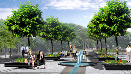
Proposed Community Plaza
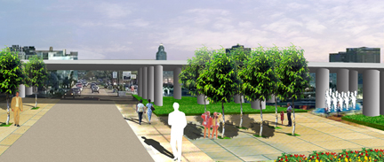
Proposed Open Space: Interstate 10 Underpass
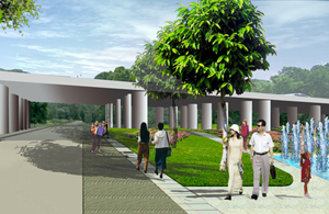
Proposed Gathering Area
Strategies
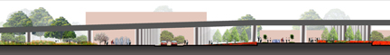
Section